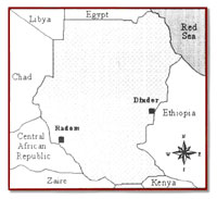
This Biosphere Reserve covers an area of 650,000ha is in southeastern Sudan on the border with Ethiopia. It lies 400km southeast of the capital Khartoum. Lions, monkeys, giraffes, leopards, bushbucks, kudus, antelope and many kinds of birds can be seen there. The park's main season is January-April. Only limited tourism is allowed.
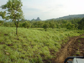
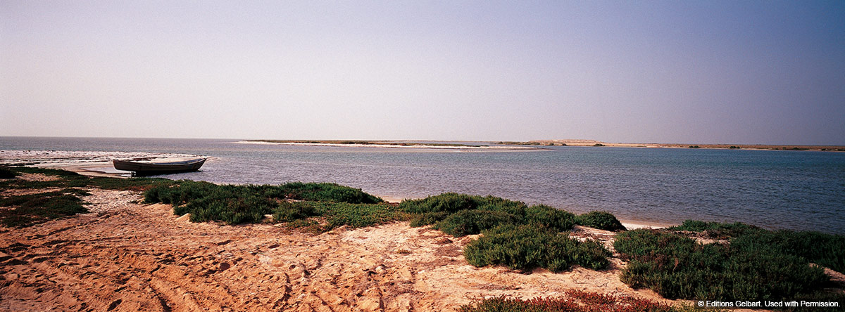
Dinder National Park was established in1935 and became a biosphere reserve in 1979.In 1980 it was extended to include a buffer zone, so that the total area today is 890,000ha. Much of the park is low-lying flood plain sloping gently from the Ethiopian Highlands with the Rahad and Dinder rivers flowing across the the Park. Both rivers are seasonal and flow from June to November. A number of tributary streams and lakes cover a large percentage of the total area towards the Ethiopian highlands, and in the southern corner of the park there are a few rocky hills. Precipitation ranges from 800mm in the south to 600mm in the north and falls mainly between June and October. Temperatures range from 20C in January to 44C in May.
The wetlands produced by the rivers and streams are vital as a source of water for the grasses grazed by herbivores, especially during the dry season. Some of these animals like the tiang gazelle are endangered. Like the rest of the Arab region, Dinder and Sudan are located on the bird migration routes, which feed on the fish ion the lakes during their visit. The ostrich population is falling due to illegal hunting.
The mammal population includes giraffe, buffalo, reedbuck, antelope, waterbuck, greater kudu, bushbuck, various gazelle species, elephant, lion, leopard, and cheetah, striped and spotted hyena.
Threats to Dinder National Park abound: it has been affected by the long civil war in Sudan, the droughts and famines. Around 50 villages lie in or directly outside the park, about 7,200 people live within the reserve boundaries. Herders, poachers, charcoal makers have contributed to the loss of the Park’s habitat. The need for food, fuel and pastures leaves people little choice but to take advantage of the resources within reach.
Local and international organizations are working in cooperation with the communities around the park and involving community leaders in the development of the Park’s buffer zone to make the project viable:
• In the past, the villagers cut trees to make charcoal; now they are planting Acacia trees in “people’s forests.” The trees offer a sustainable supply of wood, as well as fodder for livestock. The trees are planted three meters apart with the surrounding lands used for growing vegetables that provide the villagers with cash income and food. So far, 17 hectares have been planted for the participating 100 households, and there are plans to add another 15 hectares for 60 additional households.
• the photovoltaic initiative was introduced to promote the use of solar energy as a substitute for fuel wood.
As both a UNESCO-MAB Biosphere Reserve and since 2005 a Wetlands of International Importance (Ramsar) the Park’s importance is recognized for the following:
• its proximity to the desert and semi-desert makes it an important buffer zone for the vegetation cover of Central Africa in addition to its significance in providing genetic material for rehabilitation in the arid and semi-arid tracts.
• it is an important watershed area protecting the most influential feeders of the Blue Nile, Dinder and Rahad rivers and their tributaries.
• the reserve, together with the south -western corner of the Ethiopian Plateau, makes, a complete ecosystem for wild animals in which the Dinder reserve is the dry season habitat for migratory species.
• It supports a high diversity of fauna and flora. It is the only area in the region where game species such as the African Buffalo, Lion and the Elephant still exist.
Source : http://www.rbas.undp.org/programme/country/Sudan/sud.pdf
map source: http://www.arabmab.net/bra.htm