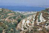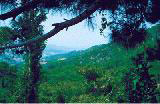
The Syrian coast consists of long stretches of beach and green mountains. These mountains are mostly covered with pine and oak trees, and their slopes touch shore. This landscape repeats itself from Ras al-Basit in the north to Tartus in the south. On the mountains are scattered villages and towns with springs of clear mineral water.
The Beaches
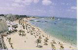
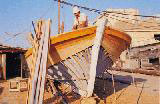
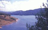
The Syrian seashore is about 175 km long, and its numerous beaches are distinguished by soft sand, unpolluted sea, moderate climate and clear blue sky.
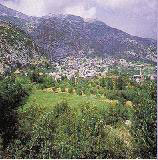
The coastal summer resorts in Syria are numerous. Scattered on the hills and mountains near the sea, they boast fresh air, cool weather in summer and moderate weather in winter.
Some of these summer resorts are:
Slenfeh
Kasab
Salma
Draykish
Misyaf
Wadi al-Oyyun
Safita
Places of archaeological interest in the district of Safita are:
Hosn Sleiman
Arima
Qal'at Yahmur
Qal'at al-Hosn (Carc des Chevaliers)
Qal'at Salah al-Din
Qal'at al-Marqab (al-Marqab Citadel)
Ras Al-Bassit
Located on the northern part of the Syrian shore, about 40 km to the north of Latakia, it is one of the most beautiful spots on the Mediterranean: a wide bay, with clear water and clean sand, surrounded by mountains and green hills. Chalets, camping sites and restaurants along the shore make Ras al-Bassit all the more attractive to visitors.
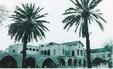
Latakia
Latakia is Syria's main sea-port on the Mediterranean (186 km southwest of Aleppo). It has retained its importance since ancient times. Latakia was one of the five cities built by Saluqos Nikator in the 2nd century B.C. He named it after his mother, Laudetia.
Not many ancient remains have survived in Latakia, but there are four columns and a Roman arch from the time of Septimus Severus (circa 200 A.D.), in addition to a beautiful Ottoman construction called "Khan al-Dukhan", which is now a museum.
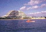
Latakia is the sea-gate to Syria. It is well-provided with accommodation, and is well-placed as a base from which to explore the coastal regions of the country.
There are beaches, mountains, archaeological sites and many relics of the Crusaders, all within a few hours from each other.
Mention should also be made of the historically important Ras Shamra, only 16km to the north of Latakia. This is the site of Ugarit, the kingdom that had a golden past in administration, education, diplomacy, law, religion and economics between the 16th and 13th centuries B.C. It is the kingdom that gave humanity the first alphabet in the world. This alphabet is still preserved on a clay tablet at the National Museum in Damascus.
Documents, statues and jewels from the Ugarit kingdom are also on display at the Latakia, Aleppo and Tartus museums.
Jableh is another Syrian seaside town, 28 km to the south of Latakia.
It has a theatre built to accommodate 7,000 to 8,000 spectators. Close to Jableh is Tel Sokas, where archaeological relies were recently found, now on exhibition at the Damascus and Tartus museums.
Banyas
This city is located on the Syrian coast, 55 km to the south of latakia. It was an ancient Phoenician seaport. The Greeks called it Balemia. It was famous for its orchards and its export of wood. Today it is better known for its oil refinery. It still contains citrus fruit orchards surrounded by green hills. On one of the hills is the imposing al-Marqab Citadel, a huge fortress of black basalt stone.
Tartus (Tartous)
The second most important Syrian seaport on the Mediterranean (90 km to the south of Latakia). It was called Antaradus by the Pheonicians and Tortusa by the Byzantines. Tortusa was to become one of supply ports for theCrusaders and a military base of considerable importance. It was held by the Templars, but recovered by Saladin in 1188.
The arches, wall-towers and narrow lanes in Tartus evoke what the twon must have been like in medieval times. A jewel of Romanesque art is the cathedral of Tartus, which is now a museum containing relics from various Syrian civilizations.
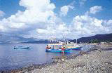
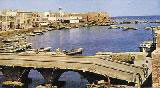
Arwad Island
This is the only island in Syria, and it is located 3 km from Tartus.
It was an independent kingdom named Aradus in the days of the Canaanites. It was often mentioned in inscriptions because of its importance in commerce and seafaring.
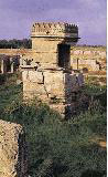
Arwad provided shelter for those escaping from foreign invasions in ancient times, especially for the people of Amrit in the south of Tartus. Amrit still retains its name since the 5th century B.C. It has a temple surrounded by water.
Arwad is a beautiful small island, with a mass of houses and fortresses with narrow lanes. It has many cafes and restaurants overlooking Tartus and the sea. Its ancient citadel was used as a prison for the nationalists during the resistance against the French. The walls of some cells in this citadel are still covered with the writings of the nationalists.