REPUBLIC of YEMEN
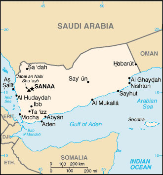
Location: bordering the Arabian Sea, Gulf of Aden, the Red Sea, between Oman and Saudi Arabia
Capital: Sana’a
Area: 527,970 sq km
Coastline: 1,906 km
Elevation extremes:
lowest point: Arabian Sea 0 m
highest point: Jebal an Nabi Shu'ayb 3,760 m
Official language: Arabic
Population: 19,249,881
Age structure: 0-14 years: 46.6%
15-64 years: 50.6%
65 years and over: 2.8%
Currency: Yemeni Rial
Member: Arab League
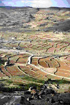
Yemen lies in the south and west of the Arabian Peninsula. It is bordered on the west by the Red Sea, on the east by Oman, on the north by Saudi Arabia and on the south by the Arabian Sea and the Gulf of Aden. It has an area of 527,968 sq km. In the Red Sea are the Yemeni islands of Socotra, Kamran, Zephir, Hanash, Fatima and Halb. The coastal plain on the Red Sea is 70m wide and barren. The plain on the Arabian Sea on the east is much narrower but has a few oases. The narrow desert plain of the Tihamah bordering the Red Sea rises abruptly to a mountainous interior. These mountains, which are heavily terraced for agriculture, attain heights of between 3,000 and 3,500 m, and include the highest mountain in Arabia, Jabal al-Nabi Shu'ayb, with a peak at 3,666 m. Further east the mountains fall away in a series of precipitous steps to the fringes of the arid Rub al-Khali (Empty Quarter). In the south, the narrow coastal plain along the coast of the Gulf of Aden is backed by a range of steep mountains rising to almost 2,500 m. North of these mountains a high plateau falls away gently to the northeast to merge with the Rub al-Khali basin. Numerous large wadis with permanently flowing water in their upper reaches descend from the mountains towards the coastal plains, the most important in terms of surface flow being the Mawr, Surdud, Siham and Zabid in the Red Sea drainage and the Hadramawt in the Gulf of Aden drainage. During the past 20 years there has been a drastic drop in the water table on the plateau in the central highlands, and this is now of considerable concern to agriculturalists. The fall in water levels has been attributed to excessive pumping of groundwater from boreholes, and reduced water retention because of the widespread collapse of ancient terraces.
The climate is desert, hot and humid along the coast, mild in the western mountains and very hot, dry desert in the east.
The climate along the Red Sea coast is hot and humid, with a mean annual temperature of 29C. Precipitation is very low, the average annual rainfall at Al-Hudaydah being 85 mm, with rain falling on only about 11 days a year. The climate along the south coast is similar, with maximum temperatures above 40C in July and August. Average temperatures at Aden range from 24C in January to 32C in July, and the average annual rainfall is 46 mm. Despite the low rainfall, the humidity is very high. By contrast, the highlands are mild with summer maxima around 29C. Winters can be cold and frosts are not uncommon. The average annual rainfall over much of the highlands is 380-500 mm, decreasing to less than 120 mm in the east.
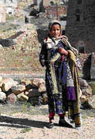
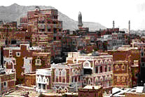
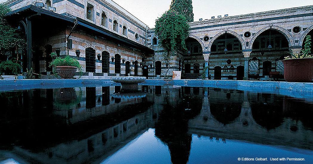
The name “Yemen” is said to come from the Arabic word “yameen” (right), indicating it is located to the “right” of the Ka’aba in Mecca. It was also known as “Arabia Felix”. Its political capital is Sana’ and its economic capital is Aden. Other cities are Ta’iz, Ibb, al Hudayda, Ma’rib, al Mukalla, and Sheikh Uthman.
Yemen is one of the oldest centers of civilization. It was ruled by the kings of Saba’ in the 7th century BC and by the Ethiopians and the Persians in the centuries before Islam which the Arabs introduced in 630AD. Many Muslim dynasties ruled Yemen, among them the Zaidis, Mahdis, Rasoulis and Salihis. In 1962 the northern region of Yemen declared independence. The southern area around the port of Aden had been a British protectorate since 1839; the British withdrew in 1967 and South Yemen was formed with the small sultanates that made up the Arabian south: Hadhramut, al Mukalla, Lahij, Beihan, ash Shahr.
In 1990, the Yemen Arab Republic (North Yemen) and the People's Democratic Republic of Yemen (South Yemen) were unified to form the present Republic of Yemen. Now, Yemen is divided into 16 provinces or Governorates, ten in former North Yemen and six in former South Yemen. Sana'a, the capital, is situated at about 2,300 m elevation in the western highlands.
Most of Yemen's population of about 11.5 million is concentrated in the western highlands and locally along the coast, and large parts of the country are sparsely populated.
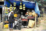
Cultivated land covers only about 6% of the country, mainly on the highland terrace system and on the Tihamah. Around 30% of the land area is grazed and 10% is classified as "woodland", with the remaining 54% being largely desert or barren, rocky hills. Crops include coffee, tobacco, sesame, cotton, grains, potatoes, grapes and melons as well as millet, sorghum, wheat, barley, pulses, dates, fruit and vegetables The qat plant, a mildly narcotic shrub, is considered a vital part of daily life in Yemen. Cotton is widely grown on the coastal plains as a cash crop.
Fishing is a major industry, particularly in the south. The industrial sector is small and is based on the manufacture of cotton textiles, cement, aluminum products and handicrafts. Yemen is now an oil producing country, and will soon produce natural gas. In 1986 the government opened an oil refinery in Ma’rib which produces 600,000 tons a day, and a second plant is being built at the port of as Salif.
Cities: Sana’a, Aden, Ibb, Ta’iz
Nature reserves: The Socotra Archipelago
Yemen’s Constitution, Universities, Tourism
photos: www.weltrekordreise.ch